
Quick summary: This season’s Chardham routes are largely open, but expect localized closures, frequent short-duration clearances for landslides, erosion-prone stretches (especially on the Rishikesh–Joshimath / NH-7 corridor and parts of the Gangotri route), special registration/QR pass checks at key points, and continuing infrastructure projects (tunnels, EV chargers) that will improve safety and capacity over time. For operational closures and live alerts always check Uttarakhand PWD/administration updates before you depart.
What’s changed this season (headline items)
- Official opening dates confirmed: The Char Dham temples have fixed opening dates this season (mid- to late April), which triggers the formal start of mass vehicular movement and road maintenance windows. Plan travel around these dates to avoid early-season rough patches.
- Localized erosion on the Gangotri highway: A critical stretch near Ratudiserra (Uttarkashi district) is showing active river erosion that could force temporary single-lane working or short closures while protective works are installed. Pilgrims heading to Gangotri should expect slower progress through that area.
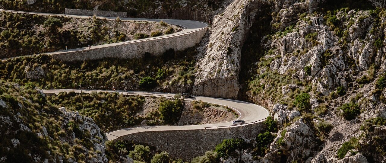
- Rishikesh–Joshimath corridor remains landslide-sensitive: The NH-7 route toward Joshimath has many small but frequent landslides; engineering teams perform nightly/rolling clearances during the season. Travel time on this corridor remains variable.
- Administrative measures & services: Registration/QR passes continue to be enforced at Sonprayag/Gaurikund and other checkpoints; Uttarakhand has added EV charging infrastructure along the route to encourage cleaner mobility. Expect checkpoints and occasional vehicle restrictions (size/width/wheelbase rules) on hill-roads.
Route-by-route practical road update
1) Yamunotri (gateway: Barkot/Sonapani)
Status: Roads to Barkot and the short mountain approach to Yamunotri are open for the season, with routine maintenance on narrow ghat sections.
Watch for: Narrow single-lane stretches, occasional boulder-clearances after rain, and village-level diversions. Local PWD teams run daily patrols in the early season to keep the route passable. For last-mile (Janki Chatti/Hanumanchatti) expect the usual uphill trek or pony/porter options.
2) Gangotri (gateway: Uttarkashi → Harsil → Gangotri)
Status: Open but with an erosion-sensitive stretch near Ratudiserra/Harsil. Authorities have flagged a 200-metre section at risk and may impose staged traffic or temporary closures if river scouring worsens. If your trip uses the Gangotri route, allow buffer time and plan for alternate overnight stops if needed.
3) Kedarnath (gateway: Gaurikund → Sonprayag → Kedarnath)
Status: Roads to Sonprayag / Gaurikund are open; Sonprayag acts as the main vehicle/registration node. The original, traditional trek route (the older 1,300-year-old path) has been refurbished and there are active infrastructure projects (including a longer-term tunnel and ropeway work) intended to decongest the narrow valley approach. However the season can still see temporary blockages near Tilwara, Sonprayag and Gaurikund after strong rain.
Important: QR/biometric registration or passes at Sonprayag/Gaurikund are strictly enforced; helicopters operate under tighter regulation after past incidents, so expect intermittent suspension for safety or weather. If you planned helicopter transfers, confirm operator status the day before departure.
4) Badrinath (gateway: Rishikesh → Karnaprayag → Joshimath → Badrinath)
Status: The Rishikesh–Karnaprayag–Joshimath corridor is open but remains the most variable due to the long NH-7 (Rishikesh–Joshimath) stretch which sees many small landslides per kilometer. Work to clear and stabilize slopes happens continuously, often at night or early morning, and traffic may be regulated by flagpersons or convoy systems.
Tip: Pipalkoti–Lambagad sectors are historically landslide-prone; drivers often reduce speed and may be stopped briefly for clearing operations. Lodging in intermediate towns (Karnaprayag / Joshimath) gives flexibility if a clearance delay occurs.
Road safety and restrictions to expect
- Vehicle size & wheelbase limits: Hill routes have enforced limits on wheelbase and vehicle width; larger buses or over-sized vehicles may be denied entry to certain hill stretches. If you’re traveling by private car, check wheelbase/vehicle size rules with transport authorities or your tour operator.
- Night-time working and convoy hours: To minimize risk, authorities sometimes allow movement in convoy windows and undertake slope-stabilization at night; expect short halts. Check with local district administration or PWD for convoy timings.
- Weather-triggered closures: Heavy rain, rapid snow at higher elevations, or river flooding will trigger immediate blockages. The Himalayan microclimate means conditions change quickly—plan conservatively.
Infrastructure & upgrades worth knowing about
- Tunnel and ropeway projects for Kedarnath: Plans for a twin-tube ~7 km tunnel and integration with ropeway systems will, once complete, reduce exposure to vulnerable ghat stretches and decrease travel time — but these are multi-year projects and do not eliminate the need for current safety checks.
- EV chargers along the route: Uttarakhand has started installing EV charging points at strategic GMVN/waystation locations to promote greener travel for pilgrims. If you’re driving an EV, map chargers in advance — not all highways have reliable fast chargers yet.
How to plan your driving to avoid surprises (practical checklist)
- Check official PWD closure page the morning of travel. The Uttarakhand PWD (road closure page) lists active closures and is the single most authoritative source for last-mile decisions.
- Build buffer time into each leg. Even a short landslide removal can add an hour or more on narrow ghat roads. Be realistic — mountain driving is slow.
- Confirm helicopter & ropeway status separately. Operators may suspend services for safety even when roads are open. If flying into Kedarnath or using ropeways, get operator confirmation on the day of travel.
- Carry essentials for delays. Water, snacks, first-aid, warm layers, and portable phone chargers — cell coverage is patchy in many valley stretches.
- Use experienced local drivers for hill legs. Local drivers know which stretches are actively managed and typical delay points. Tour operators and GMVN services can help.
Realistic expectations for traffic and footfall
Mass movements spike around the official opening dates, major festivals (e.g., Ganga Dussehra, local fairs), and long weekends. Recent seasons have seen moderately fluctuating footfall due to weather and operational changes; expect peak traffic near base towns and major parking nodes (Rishikesh, Rudraprayag, Joshimath, Sonprayag). Authorities sometimes limit vehicle movement near shrine approaches to manage congestion.
Live-information resources (must-check before you go)
- Uttarakhand PWD / road closure portal — official daily closures and re-opening notices.
- District administration social handles (Rudraprayag, Chamoli, Uttarkashi) — for immediate local advisories and convoy schedules.
- Temple/Devasthanam websites or GMVN — opening dates, registration, and vehicle rules.
- Major national/regional news outlets (for erosion/major incident reports) — useful for early warning on major washouts or long closures.
Final recommendations (practical & safety)
- Don’t treat mountain roads like plains: short distances can take many hours. Plan one major hill-leg per day and allow an extra day as buffer.
- Confirm registrations and passes: carry printed & digital copies of QR passes and ID; checkpoints are strict.
- If you’re risk-averse, consider mixed travel: combine road travel with authorized helicopter legs or staged stays to avoid risky night driving. But note helicopter services are subject to weather and increased regulation after recent incidents.
- Stay updated the morning of travel: check the PWD road-closure page and district notices. If you see reports of active erosion or major landslides along your chosen corridor, postpone that leg or pick an alternate route.
Want a quick checklist / printable?
If you’d like, I can produce a one-page printable “Road-Status Checklist + Live-links” PDF that pulls in the official PWD link, district emergency numbers, and a short packing checklist (water, first aid, warm clothes, power bank). Tell me which shrine order you plan (Yamunotri → Gangotri → Kedarnath → Badrinath or the reverse), and I’ll generate it right away.
Sources & further reading: Official PWD road-closure portal; Uttarakhand tourism/GMVN pages; Times of India coverage of erosion & route reopenings; peer-reviewed survey on NH-7 landslide frequency; regional travel & registration updates.


